
January 27, 2026 | 09:36 am
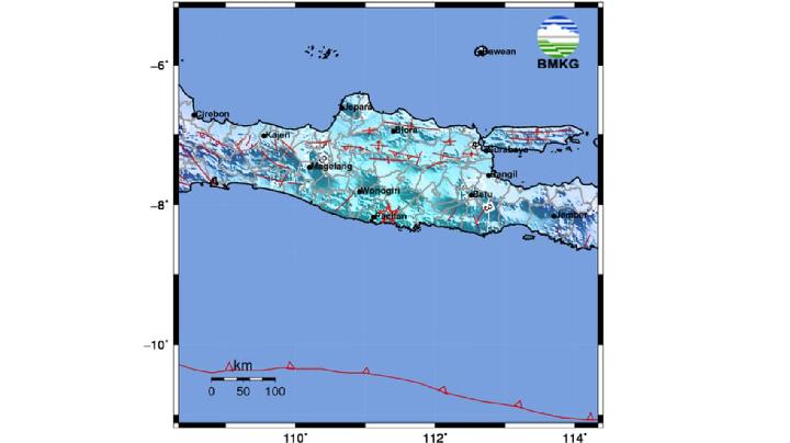
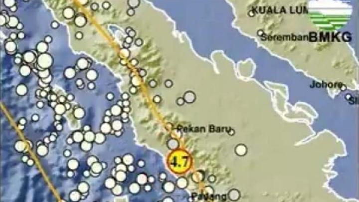
TEMPO.CO, Jakarta – The Indonesian Meteorology, Climatology, and Geophysics Agency (BMKG) reported a tectonic earthquake struck Pacitan, East Java, on Tuesday, January 27, 2026, at 8:20:44 a.m. Western Indonesian Time (WIB). BMKG analysis indicates the earthquake had updated parameters with a magnitude of M5.7.
The earthquake's epicenter was located at coordinates 8.18° South Latitude and 111.33° East Longitude, or precisely on land 24 kilometers southeast of Pacitan, East Java, at a depth of 122 kilometers.
"Based on the location of the epicenter and the depth of the hypocenter, the earthquake was a moderate-sized earthquake caused by rock deformation activity within the plate," Daryono said in a statement on Tuesday. "The analysis of the source mechanism indicates that the earthquake was a thrust fault."
The earthquake was felt in Pacitan, Karangkates, and Tulungagung at an intensity of III-IV on the MMI scale, meaning that during the day, many people felt it inside their homes.
In Malang, Nganjuk, Ponorogo, and Blitar, the earthquake was felt at an intensity of III on the MMI scale, meaning that the tremors were felt inside homes and felt as if a truck were passing by.
In Madiun, Denpasar, Kuta, Karangasem, Jember, and Mojokerto, the earthquake was felt at an intensity of II-III on the MMI scale, meaning that the tremors were felt inside homes and felt as if a truck were passing by.
In Yogyakarta, Bantul, Sleman, Kulon Progo, Purworejo, Semarang, Pasuruan, and Mataram, the earthquake was felt at an intensity of II, meaning that the tremors were felt by several people and caused light hanging objects to sway.
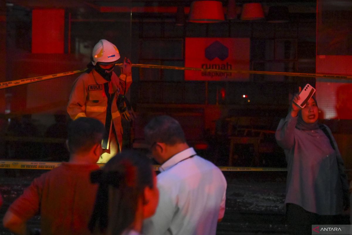
To date, there have been no reports of damage caused by the earthquake. Modeling results indicate that this earthquake does not have the potential to trigger a tsunami.
As of 08.35 WIB, BMKG monitoring results had not shown any aftershock activity.
Read: BMKG Reports Earthquake Data for Bekasi Regency, West Java
Click here to get the latest news updates from Tempo on Google News
BMKG Reports Earthquake Data for Bekasi Regency, West Java
23 jam lalu
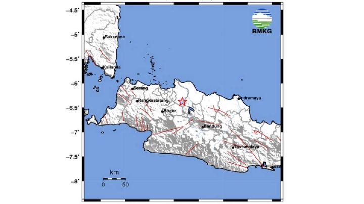
An earthquake with a magnitude of 2.7 hit Bekasi Regency in West Java and the surrounding area.
Indonesia's Mount Slamet Sees Spike in Volcanic Earthquakes
15 hari lalu

Mount Slamet in Central Java, Indonesia, is reported to be experiencing an increase in magmatic gas activity.
BMKG: Strong 7.1 Earthquake Jolts North Sulawesi, No Tsunami Risk
16 hari lalu

BMKG detected a 7.1 magnitude earthquake in Melonguane, North Talaud Islands, North Sulawesi on Saturday, January 10, 2026 evening.
Geological Agency: Indonesia Saw 41 Destructive Earthquakes in 2025
20 hari lalu
Most of the destructive earthquake events are caused by active faults located on land.
6.2-Magnitude Earthquake Jolts Western Japan
20 hari lalu
The initial quake was followed by a sizeable number of aftershocks.
Another Earthquake Hits Aceh's Bener Meriah Region, BMKG Reports
22 hari lalu
Another earthquake hits Bener Meriah and Central Aceh after the series of tremors at the tail end of 2025
Indonesia's West Java Records 1,242 Earthquakes in 2025, BMKG Says
25 hari lalu
BMKG said most earthquakes in West Java were shallow, occurring at depths of less than 60 kilometers.
Aceh Jaya Shaken by Earthquake Triggered by Great Sumatran Fault
26 hari lalu
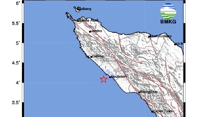
The earthquake that occurred is a type of shallow earthquake caused by the activity of the Great Sumatran Fault on the submarine fault.
Volcanic Activity Level Raised for Mount Burni Telong as Aceh Hit with Tremors
27 hari lalu
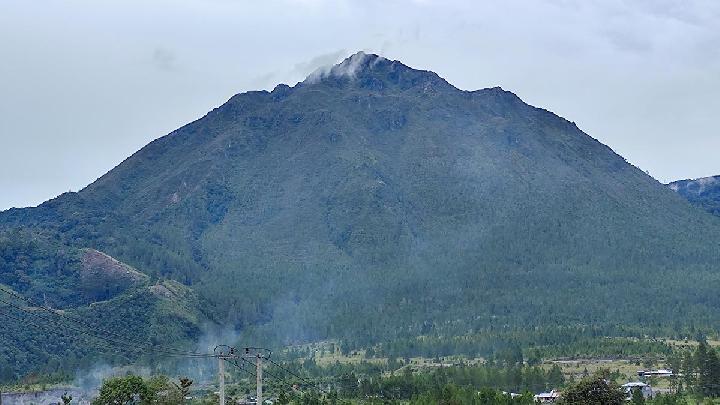
The Geological Agency announces the elevation of activity status of Mount Burni Telong in Bener Meriah, Aceh.
BMKG Records 17 Aftershocks After M4.7 Tremor in Indonesia's West Sumatra
28 hari lalu
Aftershocks from the recent earthquake prompt BMKG to warn residents of high landslide risk due to heavy rainfall.


:strip_icc():format(jpeg):watermark(kly-media-production/assets/images/watermarks/bola/watermark-color-landscape-new.png,1125,20,0)/kly-media-production/medias/5343503/original/009674500_1757434237-20250909AA_Timnas_Indonesia_U-23Vs_Korea_Selatan-03.JPG)


:strip_icc():format(jpeg)/kly-media-production/medias/5118338/original/096777400_1738505541-20250202BL_Kedatangan_Patrick_Kluivert_dalam_Laga_Persija_Vs_PSBS_7.JPG)
:strip_icc():format(jpeg)/kly-media-production/medias/5390165/original/033586000_1761235850-Persib_Bandung_1.jpeg)


:strip_icc():format(jpeg)/kly-media-production/medias/5385175/original/090228500_1760881526-Bali_United.jpeg)
:strip_icc():format(jpeg)/kly-media-production/medias/5267951/original/037003100_1751185942-souza.jpg)
:strip_icc():format(jpeg)/kly-media-production/medias/5321271/original/035046300_1755668869-ong.jpg)


:strip_icc():format(jpeg):watermark(kly-media-production/assets/images/watermarks/bola/watermark-color-landscape-new.png,1125,20,0)/kly-media-production/medias/5233597/original/013085700_1748319472-IMG_9065.JPG)
:strip_icc():format(jpeg)/kly-media-production/medias/4605399/original/051919700_1696925599-Timnas_Indonesia_-_Arkhan_Fikri_dan_Hokky_Caraka_copy.jpg)